I’ve been planning overland adventures or let’s call them giant road trips, for the last decade. With all that experience in my pocket I look to answer your questions about your adventure dreams.
Can You Drive a Car From North America to South America?
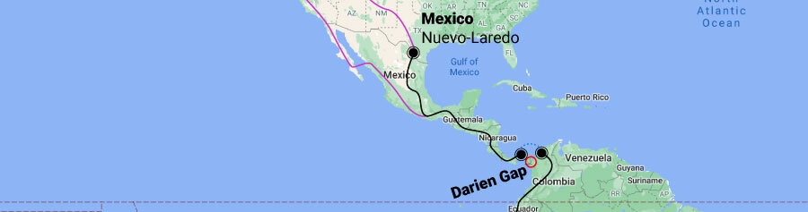
Yes you can, however it does involve shipping your vehicle over the Darien Gap between Central and South America. This stretch of dense jungle doesn’t have any drivable roads. The rest of the route through North, Central and South America is paved highway.
I’m sure you have more questions, so in the rest of this article we will discuss what the official route looks like, learn more about the Darien Gap, discuss how long it would take to drive the entire distance and discuss safety on different parts of the route. It is a long article so I hope you have your coffee ready!
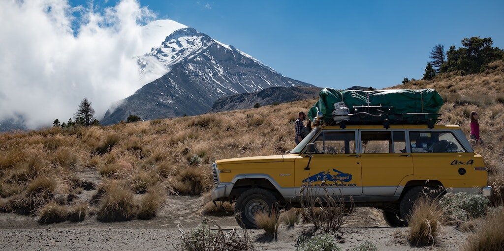
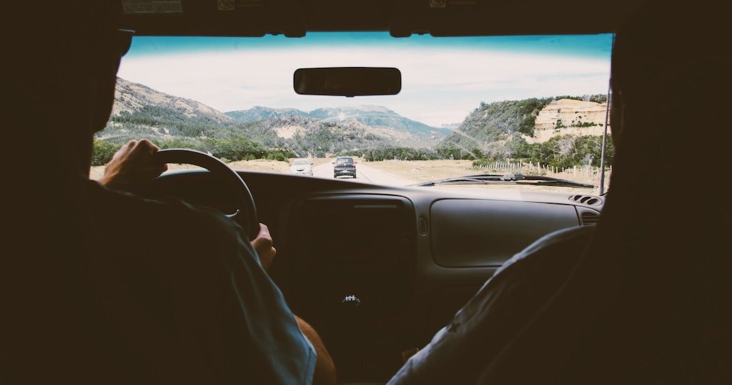
Photo by Jon Hieb

Let’s flip the question around…
Why Can't You Drive From North America to South America
Even though geographically North and South America are connected by land, on the edge between Panama and Colombia there is no road linking the two countries and continents therefor you cannot drive from one continent to the other.
But you typed this question into google, so you must be intrigued by the idea, or maybe watched a show like Long Way Up. Or maybe you want to visit relatives in South America. Whatever the reason you are interested, I’ll share all the details you need to know before heading off on such an adventure.
A little history lesson
The first proposal of infrastructure connecting the two continents was proposed at the first Pan-American Conference in 1889. The original plan was to build a railroad but the idea never came to fruition. As cars started to become the popular mode of transportation, the concept changed into a highway.
After the great depression, all countries from North to South signed a convention to speed up construction. Mexico was the first country to complete their section of the highway network. In Latin America, the roads that are part of the official Pan-American highway are also marked as Vía Panam or Vía Panamericana. The only official section starts in Laredo, Mexico and ends in Buenos Aires, Argentina. The USA was only a supporter of the convention, but was never part of the plan. Most people consider the entire highway system in the USA as part of the Pan-American. Similarly in Canada there is no official route.
The unofficial route
That means that in the North there is no official route to follow, even if you would want to. However, most people who embark on this life changing adventure, drive north to dip their toes in the Arctic Ocean and use this as the official starting point. Traveling through Canada and the Rocky mountains before heading back to the USA where you can stick to the West coast or go exploring. For non US residents that part of the adventure can easily take up a year if you would take the time to enjoy each state.
Central America leaves less room for exploration as the land physically narrows to 38 miles or 61 kilometres. After reaching Panama you could turn around and explore the other coast going up and that would be an amazing adventure by itself. If you’ve set your mind on driving to South America, this is the point where you will have to find transportation for your vehicle to the other continent. Depending if you travel by car, rv, truck, motorcycle or bicycle you have different option.
In South America the route also largely follows the West Coast crossing different countries until reaching Chile where it bends of the reach across to Buenos Aires. Most travellers finish the route by driving all the way down to Tierra del Fuego and the town of Ushuaia which is the southern most town reachable by road.
How long does it take to drive the Pan-American highway?
The official section from Laredo, Mexico to Buenos Aires, Argentina is 7,244 miles / 11.658km long and would take between 21 - 29 days driving every day 8 - 6 hours straight.
The unofficial route from Alaska to Ushuaia is 10,927 miles / 17.586 km and takes a minimum of 28 days to complete. Even though the fastest record is 11,5 days, most travellers will take at least 6 months to complete the journey. Having more time means you can stay longer in places you like or take more detours from the main road. Both of which I highly recommend because the main highway isn’t what is going to make this journey memorable.
How long should you drive each day on a road trip?
On a long road trip you should not drive longer then daylight allows you to. Driving at night is the biggest risk you can take. On average calculate with 6 - 8 hours of driving time each driving day and schedule a break day every three days.
How much does it cost to drive the Pan-American Highway?
Most people spend between US$20 - US$100 per person per day driving the Pan-American highway. An average journey of Alaska to Ushuaia lasting 6 months, 2 people in a car will cost about US$20,000 including shipping the car twice.
It really depends on your style of travel in what range your budget will lie. A shoestring budget traveling by bicycle and bushcamping or couchsurfing most of the times will be at the bottom end of the spectrum whereas staying in a few luxury hotels, doing a trip to the Galapagos or eating out in a nice restaurant in every capital will shift you to the higher range.

Is the Pan-American Highway dangerous?
No, driving the Pan-American Highway is not particularly dangerous. The biggest risks are other traffic users and animals on the road. As well as driving at night. Take the right precautions and use common sense to stay safe.
You might google this question and see some posts from the most dangerous road in the world, but I wouldn’t take that page too seriously for most of the sections they write about. As well as reading about the Darien Gap being a dangerous place to drive. Factually, nobody except crazy ex-marines dare to embark on the expedition to cross this piece of jungle, all other travellers are pragmatic and ship their vehicle across.

What is the most dangerous part of the Pan-American Highway?
It is difficult to factually pinpoint a geographical area that is the most dangerous part of the Pan-American Highway. The official crime and theft rates are highest in Guatemala according to the World Bank. However there are many other dangers that you need to take into account.
Danger is a broad term that cannot be measured because it is undefined. Does is mean the amount of murders or the amount of robberies that happen yearly in a country? What about car accidents or flash floods? All of those things you need to take into account while assessing if a country is safe enough to travel through. My personal biggest fear, after doing two big overland trips, are the other traffic participants and getting into a car accident.
Road safety
Factually, South America is safer to drive than on the African continent, but it’s in second place when it comes to estimated road traffic deaths according to the World Health Organisation. The Pan-American highway is a well maintained stretch of road crossing through multiple countries and what makes it dangerous is the fact that the unwritten rules of the road change while you drive and before you know it you are in a whole different culture and environment that you’ve never driven in before.
This requires you to adapt your driving style, observe how the locals do and adapt to allow the the be able to anticipate your behaviour. Don’t do this for everything you see, because cutting corners where you can’t see anything is lethal wherever you drive.
Use common sense to stay out of harms way
I’m sure you also have your preconceived ideas about safety in places like Mexico, or Colombia and off course there is truth to the horror stories you hear on the news. But at the same time, you have to realise that 99.9% of the time you can easily avoid those kinds of situations and stay safe. As long as you use common sense and don’t do or smuggle drugs, do anything that is illegal in the country you are traveling through, avoid conflict with locals, stay away from conflict areas and be aware of the weather around you.
Those are the main point that should keep you safe and out of harms way. Even when we were traveling through Sudan amidst a public uprising that eventually toppled the president and our embassy was advising all travellers to evacuate we stayed in the capital, where most of the protesting was happening and stayed out of any trouble and safely crossed the country to our next. So as long as you follow the advice of the locals, doing what they do to stay safe, you will probably be too.
Is the Pan-American Highway paved?
Yes, the official stretch from Mexico to Argentina is completely paved and in excellent condition. Except for the Darien Gap, between Panama and Colombia, where there is no road at all.
You can travel the Pan-American highway in any kind of vehicle you would like, it doesn’t have to be an offroad capable 4x4. Even the long version, from Alaska to Ushuaia can be done without an all terrain vehicle. As far as I know, this entire route is also paved although the quality will vary.
If you want to venture off the main route and explore the smaller villages and remote mountain passes, you will be better off with a vehicle that is not a low riding ferrari but most of the time a normal 2wd car with decent all terrain tires will do the job.
Getting down into the details of traveling the PanAm highway
For the rest of this article I’ll divide the journey into three sections: North America and Alaska Central America and the Darien Gap South America and Ushuaia
For each section we will discuss the route options, the safety issues, time to take and the best season to travel in.
North America and Alaska
The journey from the United States to Alaska is not an official part of the Pan-American Highway, but a lot of travellers want to experience everything the Americas have to offer from the most Northern point you can reach by road. For most that means driving to Prudhoe Bay although in the last few years the more adventurous route through Canada to Tuktoyaktuk has also been gaining popularity. Wether you choose Alaska or Canada, there are a few common risks involved.
How hard is it to drive to Alaska?
In general, driving to Alaska is not extremely difficult, however there are long sections without any habitation and breaking down might mean you have to wait for help for a long time. This can be dangerous is the cold winter months.
As a traveler you have the luxury of time, so take advantage of that to stay safe on the long boring drives. In summer, daylight lasts deceivingly long, which can give you the impression you can keep going.
I don’t think I need to mention it, but since there are not that many people in Alaska, you will need to prepare for the long stretches and bring enough fuel, food and water as there won’t be a Starbucks every 10 minutes.
The other issue we already talked about is breaking down, we all hope our vehicle doesn’t let us down, but sometimes it’s just a matter of bad luck. It is not a bad idea to have a basic tire repair kit with you and knowing how to put on your spare tire so you can keep going and stay safe for the night. Even if you don’t plan to camp on a trip like this, for these kind of situations it is a good idea to have at least some warm sleeping bags in your vehicle for an emergency overnight stay.
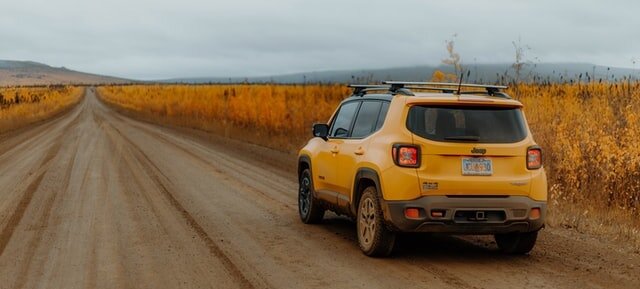
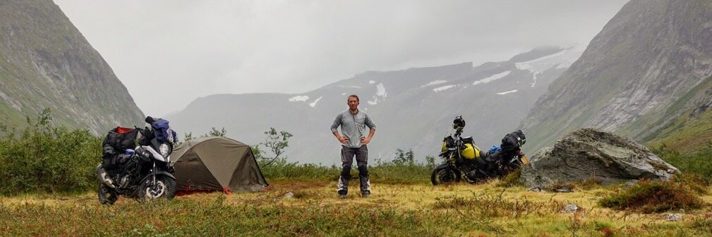
Photo by Chris Henry
How long does it take to drive to alaska?
Driving from Seattle to Prudhoe Bay takes 7 - 9 days of continues travel for 8 - 6 hours a day. This route goes through Canada so make sure to bring your passport.
The route takes you from Seattle, passing by Vancouver heading to Prince George and up to Whitehorse. Here you decide if you want to drive to Alaska or go up the Dempster highway to Tuktoyaktuk. You cross into Alaska at the Alcan border and continue to Fairbanks. From there it is a long a lonely way up to Deadhorse in Prudhoe Bay.
This last part is called the Dalton highway and very busy with trucks all year round. Not every part of the highway is paved, although accessible with any road vehicle in summer. In winter most travellers should think thrice before attempting the drive. Therefor I do advice to do this part of the trip in summer, anywhere in between May and September would be best. It is also the time when nature is blossoming which gives spectacular views with the white mountain peaks.
One of the reasons more and more people are deciding to drive up the Dempster (Canada) highway instead of the Dalton (Alaska) is that you cannot actually reach the Arctic Ocean by yourself in Alaska. That is because it is part of a restricted area where the oil fields are. To be able to dip your toes in the Arctic ocean you need to pay US$69 per person to go on a shuttle and get you there whereas in Canada you can drive yourself to the end of the Dempster highway and take a picture under the sign that says Arctic Ocean. You can even take a swim if you dare!
How much does a road trip to Alaska cost?
A three week road trip through Alaska will cost around US$75 per person per day adding up to a total of US$3.150. This doesn’t include any expensive excursions like dogsledding or a whale watching cruise.
In the end it really depends on your budget and travel style how much you spend in Alaska. It is relatively more expensive compare to other parts of the Pan-American Highway especially for accommodation and excursions. I highly recommend taking a trip down to Anchorage, not to visit the city but for the amazing scenery along the way and down in the bay area.
Is driving to Alaska worth it?
If driving to Alaska is worth it depends on your goals, however the road trip is a gorgeous one and is going to make for a memorable trip and having a your own car and equipment to explore will give a huge amount of freedom. If it is worth your time and effort is up to you to decide.
Is it worth it to make it a part of your PanAm adventure? That also depends on your goals, time and budget. If it means you’ll have to rush the rest of the trip, then I would say no. Alaska is always going to be “around the corner” whereas South America is a long way away. Focus on what you are looking forward to explore the most and don’t look at “official” routes or what other people are doing.
Making your way down through Canada and the United States
Once you’ve made it to the top of the continent, or not, it is time to make your way down. Since the USA made the entire highway network part of the Pan-American Highway, you have options here albeit pretty straight forward. Head down in a straight line following the West Coast Head inland once in a while to explore some national parks and mountain ranges Go everywhere you ever wanted to visit and leave a real messy line on the map, because who cares I’m not going into any detail here about those routes because I’m guessing that is not why you are here, so we’ll jump right into the next section of the trip through Mexico and Central America.
Central America and the Darien Gap
Just South of the border on the east side of Mexico, lies Laredo, the official start of the Pan-American highway, however most travellers stick to the West Coast on the Pacific because the roads and scenery are better. Or because of the world class waves, whale watching options and the cool Spanish ruins.
However you choose to descend through Mexico, it will bring you to the border with Guatemala. Just like Mexico and Costa Rica, the inlands of Guatemala is quite mountainous and rough. The official route sticks to the coast where it is flat and easy to drive. Choose your route wisely and based on your vehicle and travel goals.
Next up on the official route are El Salvador, Nicaragua, Costa Rica and Panama. All these countries are covered in lush greenery. That is because it get’s plenty of rain throughout the year. The official Pan-American highway route remains close to the coast, where it is easy to drive. Except from a small area in the North, Nicaragua is mostly flat. But it has some of the friendliest locals, great surf, some beautiful colonial architecture and a lot of volcanoes that you can hike up.
Once you get to Panama, you will have to find your way over or around the Darian Gap, more on that later, which signifies the end of your trip through Central America. How exciting, onto a new continent! But first, some more details about Central America to help you prepare.

What is the best time to travel to Central America?
The best time to travel through Central America is between November and April, which is the end of the rainy season in most of the region. At the coast, the temperatures stay consistent throughout the year at an average of 25°C or 77°F. Temperatures can drop significantly at higher elevation.
From May until October the rainy season arrives with 200 - 400mm of rain each month. The rainy season can be quite beautiful with greener landscapes, lower prices and fewer tourists around. The rain usually doesn’t start until the afternoon so the mornings are perfect to explore. Find shelter on time and sit out the rain reading a book the rest of the day. It sounds quite romantic, doesn’t it?
Be aware that rainy season also brings the risk of floods, in some parts of Costa Rica the roads and rivers will merge into one and easily sweep you and your vehicle off the tarmac.
How long would it take to drive through Central America?
Driving from Mexico to Panama will take about 10 days, driving every day for 6 - 8 hours a day. With a vast amount of history, nature, activities and culture to explore, it is recommended to plan at least 2 - 6 months for this trip.
I feel like I am starting to repeat myself, but again, make this trip your own. Don’t stick to the official Pan-American highway but venture out and see the small towns in the jungle. There is so much to see and do in this part of the world that driving straight through would be a waste of your time. My recommended time planning, 6 months, going to Mexico in October and heading on to South America around March.
Is driving through Central America dangerous?
Driving through Central America has it’s risks, but so does driving anywhere else in the world. For foreigners traveling through the most important safety rule is: Do not drive at night.
Look, I’m not here to tell you that it is all daisies and rainbows in these countries. We all know it is not. But as a general rule of thumb you have to understand that the troubles you see on the news are conflicts between drugs gangs, law enforcement and the press. As a tourist you are not necessarily on their radar.
Petty crime exists, just like in any other place. This means that you use your common sense to keep yourself and your stuff safe. There will be places where you drive with your windows rolled up and doors locked. Where you will always find a hotel with a gate or garage to safely store your vehicle at night. Things like that.
It is up to you to decide if you want to take the risk of losing some stuff vs the reward of exploring. For me, it is always worth it. So it has been for thousands of fellow travellers who have done this route before you.
The next topic we need to discuss is how to get to south america? Let’s assume that you’ve driven all the way to Panama and are ready to explore the other continent. You keep on driving until you get to the end of the road in Panama. That is right, the road ends in Panama. Before your eyes arises the densely packed jungle of the Darien Gap.

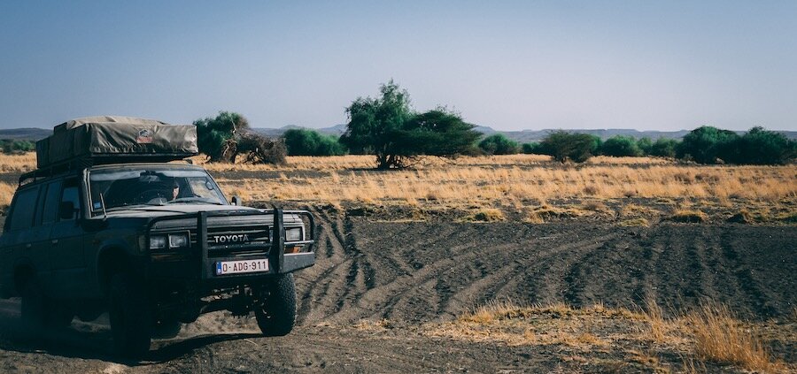
Photo by Chris Abney
Why is there no road between Panama and Colombia?
The narrow stretch of land in between Panama and Colombia is covered in dense jungle filled with exotic animals, swamps, drug smugglers and guerillas. It serves as a natural protective barrier between North and South America and environmental concerns blocked both attempts at building a road.
It is not impossible to drive through with a car or motorcycle and several expeditions have managed to do so but most ordinary people take the more sensible approach and find their way around.
How do you get around the Darien Gap with a vehicle?
On a (private) boat, taking your vehicle on board with you Shipping your vehicle on a RORO ship, while flying yourself In a container on a ship, while flying yourself Flying over
Those are the 4 options that exist and depending on the type of vehicle you are traveling with some of those might not be available.
Finding a boat or sail ship to take you across such as the Stahlratte is not impossible and quite an enjoyable way to get around the Darien Gap but only works with small vehicles such as bicycles and motorcycles.
Shipping your vehicle in a container, even if you share the container with other travellers vehicles can costly and your vehicle will have to fit inside. Standard cars and 4x4s will have no issues and motorcycles are great to fill up a container. Bigger rigs might be too tall and therefor are condemned to RORO shipping.
Roll On, Roll Off or RORO shipping is a vessel designed to transport vehicles. Any shape or size will work on these boats as they are gigantic. There is a risk that comes with shipping in this way because you need to hand over the keys so the company will be able to drive your vehicle on board. If there is a lot of your gear on board you might find a few items missing at the end of the journey. The reward is that RORO is usually cheaper then container shipping.
The last option of flying over is practically also only reserved for motorcycles and bicycles because you pay for weight instead of size making cars and trucks too expensive to transport in this way. Two wheelers are still doable and the costs are comparable to the other options.
Is there a ferry from North America to South America?
There is currently no ferry service available, the last time the Ferry Xpress sailed was in 2002. All plans to launch a new sailing schedule from new investors seem to fail and no new plans have been published in the last 5 years.
You’ve now made it to South America! Let’s dive into the challenges and rewards of this new continent together.

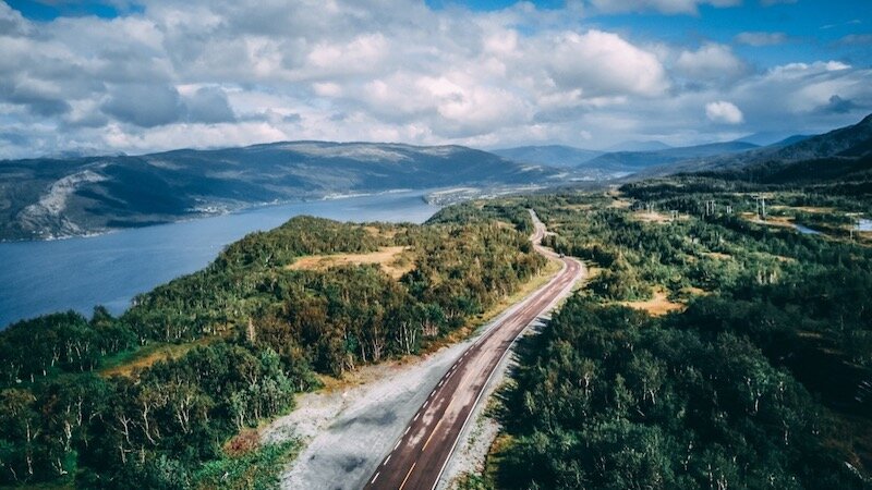
Photo by Peter Conlan - Bolivia
South America and the end of the world
Welcome to the new continent! I hope by now you have picked up some Spanish, it will help you connect with the locals (even though some speak Portuguese) and make the adventure overlanding bright and bubbly.
Starting in Colombia, at the moment I would not suggest traveling to Venezuela, so stick to the West coast while traveling Southwards. You will be able to visit Equador, Peru, Bolivia and Chile. All of which have a rich culture and natural gems to offer.
From there you can choose to end your trip in Santiago de Chile, Buenos Aires or continue down to the end of the world in Ushuaia. A popular destination for travellers who have come all the wat from the USA.
However, don’t underestimate the road leading south because the weather can be very cold. Especially in the winter months, however even in the summer the high winds make the temperature feel much lower than it actually is.
As well as this part of the world is fairly remote with not a lot of habitation so no shops or rescue service nearby. It requires a self reliant mentality, but if you’ve made it so far in your own vehicle, I’m guessing you will do just fine.
How long does it take to drive around South America?
It takes 24 days of continues driving to travel from Northern Colombia to Southern Argentina, but most travellers will take between 6 months to 1 year. To circumnavigate the continent it would take at least 1 year to complete.
However, you can take as much time as you have or as your budget allows. There is so much to explore so squeeze out every opportunity to extend your trip, I promise you won’t regret it by the time you get home.

Photo by Bruno Regge - Argentina
How far south South America can you drive?
The furthest south you can drive in South America is Ushuaia in Argentina and make your way to the end of highway 3. This is where the road stops and only boats are able to navigate the islands scattered around before you hit the open ocean.
Is it worth driving there? I think it is, Patagonia has a unique landscape and the drive will feel like a real adventure.
How much do you need to travel South America by car for 3 months?
Most people spend between US$20 - US$100 per person per day traveling in South America. An average journey from Colombia to Chile lasting 3 months, 2 people in a car will cost about US$8,100.
South America really gives you the option to travel cheap with plenty of wild camping opportunities, cheap street food and affordable accommodation. As well as the option to live the rich life and stay in fancy hotels. What makes an average trip more expensive is the money you spend on excursions such as hiking the Inca trail, a Galapagos cruise or an expedition onto a Patagonian glacier. It is probably a once in a lifetime experience, so keep a piece of your budget aside for the things that are really on your bucket list.
Is it safe to drive in South America?
Yes, it is generally speaking safe to drive in South America. The level of safety depends on the quality of the roads, traffic volume partaking, behaviour of other drivers, amount of animals on the road and if you are used to driving there.
Some countries or even regions or cities in certain countries will be safer to drive than others. Most people would not want to drive around in Paris or Delhi either. However, I’ve found that on long overland trips you slowly get used to the different traffic culture of far away countries an by the time you arrive on the other side of the world you are fully integrated and accustomed to the local traffic.
When it comes to safety due to criminal activity, the same rules apply as in Central America. Do not, I repeat, do NOT drive at night, keep an eye on the local news and ask locals how the areas that you are planning to visit are safety wise. Use your common sense and you will be fine.
What is it like to drive in South America?
Quite similar to the USA or Europe, the quality of the main road network is excellent. Inside big cities people tend to forget about traffic rules. In rural areas the road quality deteriorates and fuel stations are harder to come by.
How to get home?
Don’t worry too much about driving here, I promise that you will be fine. We’ve made it to the end of the world by car an now it is time to get back home. You have three options: Drive back Ship and fly back Cruise back
The first option, if you have the time, is a great one. I’m sure there will places you missed or might want to visit again. In South America it is possible to follow the other coast to get back up north.
Another option is to drive to Santiago de Chile, Buenos Aires or Montevideo and ship your vehicle back home and step into an airplane yourself. Or ship onwards to the next continent now that you are hooked on overland traveling.
Last option is to book a cargo ship and cruise together with your vehicle back to the USA. Traveling on a cargo ship is not for everyone, it is not a cruise. But it is a great way to slow down and experience what life on a boat is like. It is unfortunately not cheap, if that was something you were hoping. Which option is the best for you, depends on your time and budget.
https://www.langsamreisen.de/en/freightertravel/north-america-south-america/

Photo by Johann Campos
Travel experiences on the Pan-American Highway
The last thing I wanted to discuss in this article are what kind of experience traveling the Pan-American highway is. It is not a short trip, it is not a race, it is not cheap. But it is everything else and more. It is a learning opportunity, it is enriching, it is exhausting, it is gorgeous and it is thrilling. I’ve never met anyone who regretted going. It is smart to prepare before you go, so you know what to expect and how to stay out of trouble, but once you hit the road the sense of freedom this kind of traveling gives you is hard to compare with anything else.
What is the difference between traveling in North America and South America?
The biggest difference between traveling in North and South America is the culture you are traveling through and the level of self reliance needed to stay out of trouble. South America a little rougher around the edges and will require you to take care of yourself.
That is not meant as a deterrent by the way, it is meant so that you prepare properly and don’t take traveling there lightly. But if you come with the right mindset, you will have a blast.
Pan-American Highway by motorcycle
The cool thing about doing the Pan-American by motorcycle is that you can follow smaller tracks and trails other vehicles can’t. You are faster then bicycles, giving a great sense of security. However, the other traffic is probably your biggest enemy with busses overtaking whenever they want. Plenty of people have gone before you on every type of bike imaginable. I would personally advise an adventure type bike, but it is really up to you.
Pan-American Highway by bicycle
Perfectly possible, although not at the speeds mentioned in this article. Even though the world record from Alaska to Argentina by bicycle is 84 days set by a crazy Austrian.
Pan-American Highway by car
The most popular vehicle on the Pan-American highway in every shape and form. From a simple sedan to expedition kitted 4x4s. Whatever fits your budget and it will take you to the other side of the planet.
Pan-American Highway by rv
Less common, but still possible. The weight of your vehicle and its offroad capability will determine where you can and can't go, but if this is your perferred style of travel... go for it!
Related articles to read next

Frequently Asked Questions
Have a read if you are interested, but most questions have been answered in the blog post above. If you’ve made it all the way down here I’m pretty sure you are now in the know to start your own adventure!
Driving the Pan-American Highway
Why is it impossible to drive to South America?
Because there is no road connecting Central America and South America on the last stretch called the Darien Gap. However, you can ship your car from Panama to Colombia and continue down to your final destination.
Can a person drive to South America?
Yes, you can drive to South America with a small caveat that you will have to ship your car from Panama to Colombia because there is no road connecting the two countries and continents.
Can you drive the entire Pan-American Highway?
Yes, the official Pan-American highway from Laredo in Mexico to Buenos Aires in Argentina can be completed by any vehicle. The drive is interrupted by the Darian Gap where the traveler will have to ship their vehicle across.
Is there a road that connects North and South America?
There is a road system that connects all the countries in North and Central America as well as in South America but the two are not connected because of the Darien Gap. A stretch of intense jungle blocks any kind of road system.
Who has traveled the Pan-American Highway?
Thousands of people have traveled the Pan-American Highway in one way or the other. Overlanding in the America’s has been gaining popularity. Most people do not follow the official route of the Pan-Am but create their own adventure.
Where does the Pan-American Highway stop?
Officially the Pan-American Highway ends in Buenos Aires in Argentina. However, most people don’t stop there and head further south to Ushuaia where the road physically ends.
Where does the Pan-American Highway begin and end?
The official Pan-American Highway begins in Laredo, Mexico and ends in Buenos Aires in Argentina. On this stretch you will find signage marking the road as Vía Panam or Vía Panamericana.
Can you actually drive the Pan-American highway?
Yes, you can actually drive on the Pan-American Highway from beginning to the end. There is a short section in between Panama and Colombia that is missing called the Darien Gap where you will have to ship your vehicle across.
Time and costs
How long will it take to drive the Pan-American Highway?
The official section from Laredo, Mexico to Buenos Aires, Argentina will take between 21 - 29 days driving every day 8 - 6 hours straight. However, if you are considering this trip for fun then it is better to schedule at least 3 - 6 months.
How long would it take to drive the Pan-American highway?
The official section from Laredo, Mexico to Buenos Aires, Argentina would take between 21 - 29 days driving every day 8 - 6 hours straight. However, if you are considering this trip for fun then it is better to schedule at least 3 - 6 months.
How long would it take to drive to Patagonia?
Driving from the southern border of the USA to Patagonia would take at least 1 month of continues traveling because the journey is at least 7,500 miles long and includes shipping your car from Central to South America.
How much does it cost to travel the Pan-American highway?
Most people spend between US$20 - US$100 per person per day traveling on the Pan-American highway. An average journey of Alaska to Ushuaia lasting 6 months, 2 people in a car will cost about US$20,000 including shipping the car twice.
Safety
Why is the Pan-American Highway dangerous?
Driving in a foreign country is inherently dangerous, however the Pan-American Highway isn’t dangerous by itself. It depends on the stability of the countries is passes through and the safety measures followed by the traveler.
Is the Pan-American Highway safe to travel?
If the Pan-American highway is safe to travel depends on the stability situation in the countries it passes through and the safety measures followed by the traveler. In general, it is safe enough to drive the entire Pan-American Highway for the average traveler.
What is the safest route to drive through Mexico?
There is no particular route through Mexico that is safer than others. A general safety rule for driving is don’t drive at night and keep an eye on the local news. Tourists are not on the radar of the cartels. Safety can be found in numbers so stay on the busier roads if that makes you feel more comfortable.
Is it safe to drive around South America?
Just like in the USA, driving in South America is realively safe. The biggest risk is getting into an accident with your car. An important safety rule is to never drive at night.
Can you drive from… to…
Is it possible to drive from Canada to Brazil?
You can drive from Canada to Brazil following the Pan-American highway. The only interruption presents itself in between Panama and Colombia where you will have to ship your car between continents because the Darien Gap is an impassable section of dangerous jungle.
Is it possible to drive from Alaska to Argentina?
You can drive from Alaska to Argentina following the Pan-American highway. The only interruption presents itself in between Panama and Colombia where you will have to ship your car between continents because the Darien Gap is an impassable section of dangerous jungle.
Can you drive from Texas to Brazil?
You can drive from Texas to Brazil following the Pan-American highway. The only interruption presents itself in between Panama and Colombia where you will have to ship your car between continents because the Darien Gap is an impassable section of dangerous jungle.
Can you drive from Florida to Brazil?
You can drive from Florida to Brazil following the Pan-American highway. The only interruption presents itself in between Panama and Colombia where you will have to ship your car between continents because the Darien Gap is an impassable section of dangerous jungle.
Can you drive from America to Brazil?
You can drive from America to Brazil following the Pan-American highway. The only interruption presents itself in between Panama and Colombia where you will have to ship your car between continents because the Darien Gap is an impassable section of dangerous jungle.
Can you drive from Alaska to Brazil?
You can drive from Alaska to Brazil following the Pan-American highway. The only interruption presents itself in between Panama and Colombia where you will have to ship your car between continents because the Darien Gap is an impassable section of dangerous jungle.
Can you drive from the USA to Brazil?
You can drive from the USA to Brazil following the Pan-American highway. The only interruption presents itself in between Panama and Colombia where you will have to ship your car between continents because the Darien Gap is an impassable section of dangerous jungle.
Can you drive from Alaska to Chile?
You can drive from Alaska to Chile following the Pan-American highway. The only interruption presents itself in between Panama and Colombia where you will have to ship your car between continents because the Darien Gap is an impassable section of dangerous jungle.
Can you drive to Ushuaia?
You can drive from the USA to Ushuaia following the Pan-American highway. The only interruption presents itself in between Panama and Colombia where you will have to ship your car between continents because the Darien Gap is an impassable section of dangerous jungle.
Can you drive from North America to Argentina?
You can drive from North America to Argentina following the Pan-American highway. The only interruption presents itself in between Panama and Colombia where you will have to ship your car between continents because the Darien Gap is an impassable section of dangerous jungle.
Can you drive to South America from Canada?
You can drive from Canada to South America following the Pan-American highway. The only interruption presents itself in between Panama and Colombia where you will have to ship your car between continents because the Darien Gap is an impassable section of dangerous jungle.
Is it possible to drive to Brazil from the US?
You can drive from Brazil to the US following the Pan-American highway. The only interruption presents itself in between Colombia and Panama where you will have to ship your car between continents because the Darien Gap is an impassable section of dangerous jungle.
Is it possible to go to Brazil by car?
You can drive from the USA to Brazil following the Pan-American highway. The only interruption presents itself in between Panama and Colombia where you will have to ship your car between continents because the Darien Gap is an impassable section of dangerous jungle.
Can I drive from California to Patagonia?
You can drive from California to Patagonia following the Pan-American highway. The only interruption presents itself in between Panama and Colombia where you will have to ship your car between continents because the Darien Gap is an impassable section of dangerous jungle.